|
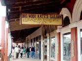
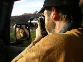
| Departing the Compound |
|
|
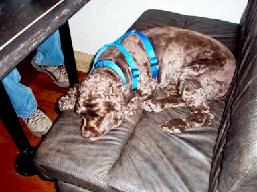
There is a certain amount of work involved in getting ourselves, our pups and the Waggin’ Wagon ready for a trip. For our first trip in 2009, we had a few “tasks” that weren’t directly related to getting ready for the trip. So, for a recap of those, click the green button below, and check out the February and March 2009 updates.
Trails Traveled in 2009
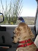
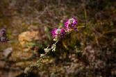
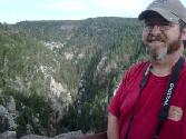
Tuesday, March 10 - We loaded ourselves and the pups for our first RV trip in 2009. Our principal destination was Arizona, but we planned to enjoy some sights along the way. As we have done before, our intent here is to share some photographs and our learnings about some of the sights we experienced along the way. So here goes!
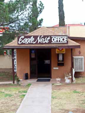
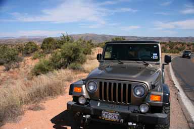
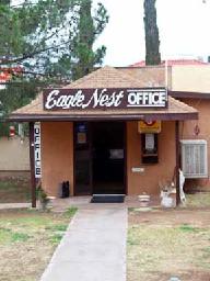
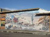
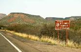
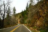
For those of you that know Texas geography, we had to travel over 400 miles just to get to El Paso from Buffalo Gap. The very western part of the state is call the “Big Bend Region” and is alternately desolate and beautiful. It is really the beginning of the “high desert.” We traveled west on I-20 through Midland and Odessa, Monahans and Pecos. We then merged with I-10 and shortly came to our first stop - Van Horn, Texas -- a small town of about 2600 people just 120 miles east of El Paso. We stayed for two nights at the Eagles Nest RV Park in "downtown" Van Horn. Here are a few Wikipedia facts and our observations about Van Horn.
Van Horn - On Friday, November 10, 2006, the Wall Street Journal reported that Jeff Bezos, founder and CEO of Amazon.com, had acquired 290,000 acres of land 25 miles north of Van Horn to house his fledgling space tourism company, Blue Origin. Blue Origin is expected to start commercial operations as early as 2010, aiming for 52 launches per year from the Van Horn, Texas facility. Home to several truck stops and an awesome Mexican restaurant - Chuy's - Van Horn serves as the crossroads for the mountain trails in deep West Texas.
|
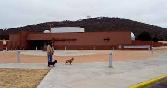
![]()
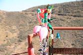
RV Park in Van Horn, Texas Spring hasn't sprung yet!
|
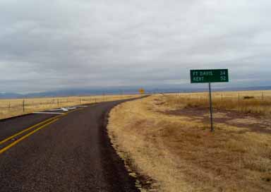
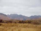
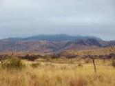
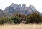
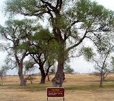
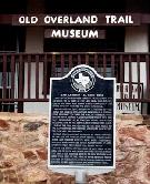
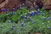
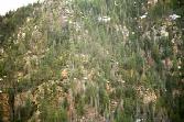
Wednesday, March 11 - So, on a cold and drizzly Wednesday, we (including Molly & Jordan) took a 250 mile scenic drive through the Davis Mountains, including stops at the McDonald Observatory, Fort Davis, Alpine and Marfa. Before viewing the photos below, here are some things you should know (and we learned along the way).
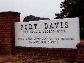
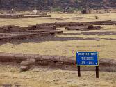
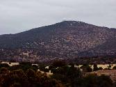
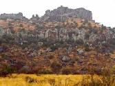
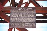
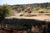
Davis Mountains and Fort Davis – The Davis Mountain Range is the most extensive mountain range in Texas, and were formed by volcanic activity 65 million years ago. These mountains were named after Jefferson Davis, U.S. Secretary of War and later President of the Confederacy, who ordered the construction of the Fort Davis army post. Few Americans had seen the Davis Mountains prior to 1846. After the war with Mexico, a wave of gold seekers, settlers, and traders came through the area and needed the protection of a military post - Fort Davis. Fort Davis was active from 1854 until 1891, except for certain periods during the Civil War. In 1961, the historic fort ruins were declared a National Historic Site, and a vast restoration/preservation program was initiated by the National Park Service.
|
![]()
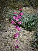
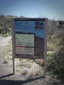
Drizzly weather for our Davis Mountains tour. Museum and marker for the San Antonio to El Paso Road First sighting of the Texas state flower
|
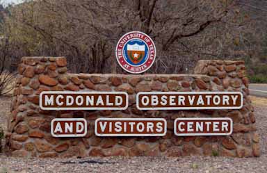
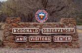
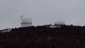
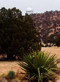
McDonald Observatory - The observatory was originally endowed by William Johnson McDonald, who left $800,000 to the University of Texas. The first telescope was dedicated on May 5, 1939, and at that time was the second largest telescope in the world. Research today at the McDonald Observatory encompasses a wide variety of topics and projects, including planetary systems, stars spectroscopy and theoretical astronomy. Home to four research telescopes, the success for the McDonald Observatory is largely due to its location in the high and dry peaks of the Davis Mountains that make for some of the darkest and clearest night skies in the region and provide excellent conditions for astronomical research.
|
![]()
Cary, Jordan & Molly in front of the visitor's center
|
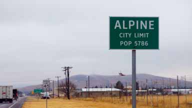
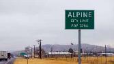
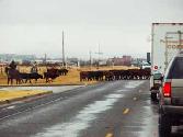
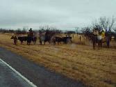
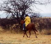
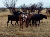
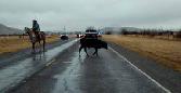
Alpine - Alpine, a town of about 5,000, is home to the main campus of Sul Ross State University, named for Texas Governor Lawrence Sullivan Ross. Positioned as the "gateway" to the Big Bend National Park, Alpine citizens boast about their mild climate and picturesque mountain setting. Traffic stopped just east of town for a herd of yearling cows that were being “moved” down the highway. Sul Ross has a pretty campus, although when we were there it was empty due to spring break. Alpine also has a brand new United States Courthouse and a large headquarters for the U.S. Border Patrol.
|
 |
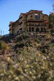
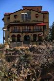
| Sul Ross State University |
|
|
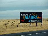
Marfa – By far the most interesting learning was about the background of Marfa, a high desert town about 2,100, was founded in the early 1880s as a railroad water stop, and grew quickly through the 1920s. Marfa Army Air Field (Fort D.A. Russell) was located east of the town during World War II and trained several thousand pilots before closing in 1945. Marfa’s Hotel Paisano served as the movie headquarters for "Giant."
While those are interesting historical facts, there are a couple of other interesting and unusual things to note about Marfa. The first is related to art. In 1971, Donald Judd, the renowned minimalist artist, moved to Marfa from New York City. After renting summer houses for a couple of years he bought two large hangars, some smaller buildings and started to permanently install his art. In 1976 he bought the first of two ranches that would become his primary places of residence, continuing a long love affair with the desert landscape surrounding Marfa. Later, Judd acquired decommissioned Fort D.A. Russell, and began transforming the fort's buildings into art spaces in 1979. Judd's vision was to house large collections of individual artists' work on permanent display, as a sort of anti-museum. Since Judd's death in 1994, two foundations have been working to maintain his legacy: the Chinati Foundation and Judd Foundation. In recent years, a new wave of artists has moved to Marfa to live and work. As a result, new gallery spaces have opened in the downtown area.
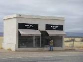
As we drove from Marfa back to Van Horn, we passed through the tiny town of Valentine. We absolutely slowed traffic down to do a double-take (and then to stop to take photos) at a small roadside building that we later learned was an art installation. On this desolate strip of US 90, there is a Prada store -- Prada Marfa, which is actually a permanent sculpture by the Berlin artists Michael Elmgreen and Ingar Dragset. The sculpture is meant to look like a Prada store, with minimalist white stucco walls and a window display housing real Prada shoes and handbags from the fall collection. But, alas, there is no working door. The artists opened the “installation” on October 1, 2005, and do not intend to maintain it. They believe that if someone spray-paints graffiti or a cowboy decides to use it as target practice or maybe a mouse or a muskrat makes a home in it, 50 years from now it will be a ruin that is a reflection of the time it was made. Only in West Texas!!
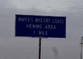
The second interesting thing about Marfa are the unexplained lights (known as the "Marfa Lights" or "ghost lights") usually seen east of Marfa. The first published account of the lights was written in 1957, citing anecdotal claims that the lights date back to the 1800s. Reports often describe brightly glowing basketball size spheres floating above the ground, or sometimes high in the air. Colors are usually described as white, yellow, orange or red, but green and blue are sometimes reported. Sightings are reported occasionally and unpredictably, perhaps ten to twenty times a year. There is evidently no connection between appearances of the Marfa lights and anything else besides nighttime hours. They appear in all seasons of the year and in any weather, seemingly uninfluenced by such factors.
|
![]()
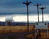
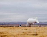
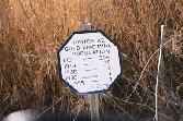
This little town welcomes tourism Beautiful county courthouse Memories of a WWII army base Interesting sign, don't you think? A federal radar adds to the strangeness of this area Looks like a huge blimp from the highway Cary in front of Prada Marfa -- what a hoot! Actual Prada merchandise on display Artists' plaque at Prada Marfa Very interesting cloud formations as we drove back to Van Horn Wow - what a beautiful sky! Notice the "giant yucca" next to the Jeep.
|
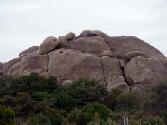
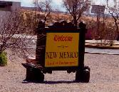
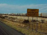
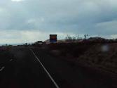
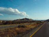
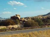
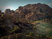
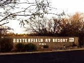
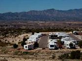
Thursday, March 12 – This was a travel day. We left Van Horn and headed west on I-10 through El Paso, Texas; Deming, NM; Lordsburg, NM; and into the small city of Benson, Arizona. We stopped at the Butterfield RV Resort, a lovely resort for which we brought the average age down dramatically while we were there. Benson was conveniently located for our explorations in Southern Arizona for a few days.
|
![]()
The sign does actually say "Caution - Dust Storms May Exist" Followed by "Zero Visibility Possible" Welcome to cloudy rainy Arizona! Here comes the valley of rocks! Interesting rock formations
|
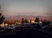
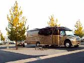
![]()
Our mountain view at sunset Cary getting us set up in camp The Waggin' Wagon at rest There are vacancies at the old Benson Motel Gluttony can abound even in Benson
|
Friday, March 13 – Happy Monthiversary! With a nightly low of the mid-30s, and daily highs in the 70s, the weather was awesome! We first explored Benson – which for the modest town of 5,000 took about an hour. We then drove the 40 miles to Tucson, and drove around the city for the afternoon. Here are some of the sights we saw:
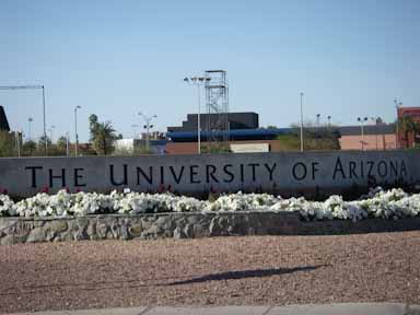
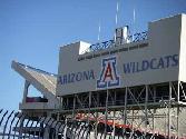
Tucson - Tucson has two major seasons, summer and winter; plus three minor seasons: fall, spring, and the monsoon. The monsoon can begin any time from mid-June to late July, and continue through August. The moderate climate is one factor in the city growing to over a half-million people. Two big employers in Tucson are the University of Arizona and the Davis-Monthan Air Force Base.
University of Arizona - The University of Arizona was the first university in the state of Arizona, founded in 1885 (twenty-seven years before the Arizona Territory achieved statehood). Located on about 400 acres in central Tucson, the school boasts an enrollment of over 36,000.
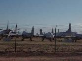
Davis-Monthan Air Force Base - The history of Davis-Monthan AFB can be traced to the earliest days of civil aviation when the city of Tucson acquired acreage southeast of town for a runway in 1925. In 1927, Charles Lindbergh flew his "Spirit of St. Louis" to Tucson to dedicate Davis-Monthan Field—then the largest municipal airport in the United States. Davis-Monthan Airport became Tucson Army Air Field, a military base in 1940 as the United States prepared for World War II. In its military role, the base became known as Davis-Monthan Army Air Field. Once the war was over, the base was selected as a storage site for hundreds of decommissioned aircraft – also known as “the boneyard.” Tucson's dry climate and alkali soil made it an ideal location for aircraft storage and preservation, a mission that has continued to this day. It was unbelievable to see the hundreds of aircraft lined up for their mission into obscurity.
|
![]()
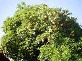
Welcome to the University of Arizona The all-important football stadium A grapefruit tree on campus A few of the planes in the boneyard of Davis-Monthan AFB
|
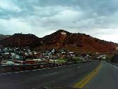
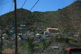
Saturday, March 14 – On this unusually cool day, we loaded up the Jeep and explored Cochise County. Our travels included Tombstone, Bisbee and Fort Huachaca. Here are some fun facts about these places:
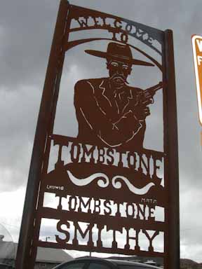
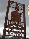
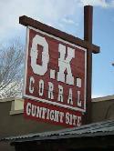
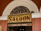
Tombstone - This town was founded in 1879, taking its name from the mining claim, and soon became a boomtown. Fueled by mineral wealth, Tombstone was a city of 1000 by the beginning of 1881, and within another year Tombstone had become the seat of a new county (Cochise County) with a population between 5,000 and 15,000. Without railroad access, the increasingly sophisticated Tombstone was relatively isolated, deep in a Federal territory that was largely unpopulated desert and wilderness. Tombstone and its surrounding countryside also became known as one of the deadliest regions in the West. Uncivilized southern gangs from the surrounding countryside, known as "cow-boys", were at odds with the northern capitalists and immigrant miners who ran the city and mines. On October 26, 1881 this situation famously exploded in the Gunfight at the O.K. Corral, involving the Earps (Wyatt, Morgan and Virgil) and Doc Holliday, together who fought the McLaurys (Frank and Tom), the Clantons (Ike and Billy) and Billy Claiborne. Thirty shots were fired in thirty seconds, resulting in the death of the McLaurys and Billy Clanton. Morgan and Virgil Earp, and Doc Holliday were all wounded. The current day residents of Tombstone embrace the tourism appeal, and walk the wooden sidewalks with six-shooters and bustly dresses. Fun to visit, especially for the kids.
|
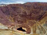
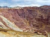
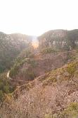
Bisbee - This town was founded as a copper, gold, and silver mining town in 1880, and named in honor of Judge DeWitt Bisbee, one of the financial backers of the adjacent Copper Queen Mine. In 1929, the county seat was moved fromTombstone to Bisbee, where it remains. Mining in the nearby Mule Mountains proved quite successful: in the early 20th century the population of Bisbee soared. In 1917, open pit mining was successfully introduced to meet the heavy copper demand due to World War I. High quality turquoise was a by-product of the copper mining and has been promoted as Bisbee Blue. By 1950, boom times were over, but the introduction of open-pit mining and continued underground work would see the town escape the fate of many of its early contemporaries. However, in 1975 the Phelps Dodge Corporation finally halted its Bisbee copper-mining operations. The resulting exodus of mine employees might have been the end of the town. The sudden flood of real estate onto the market and crash in housing prices, coupled with an attractive climate and picturesque scenery, led to Bisbee's subsequent rebirth as an artists' colony in the early 1970's. Artist Stephen Hutchison, purchased and renovated the town's anchor business and architectural gem, The Copper Queen Hotel. He also purchased several other buildings in the downtown, which included a turn of the century Brewery and Stock Exchange. Hutchison began to actively market Bisbee as a destination where travelers could find the authentic, old southwest. John Wayne was a frequent visitor to Bisbee and The Copper Queen. In the 1990s, Bisbee developed a more polished look, complete with coffee shops and live theater. Many of the old houses have been renovated, and property values in Bisbee now greatly exceed those of other Southeastern Arizona cities. Today, the original city of Bisbee is known as "Old Bisbee," and is home to a thriving downtown cultural scene. Old Bisbee is also noted for its architecture, including its Victorian houses and elegant Art Deco courthouse. Because its plan was laid out before the automobile, Old Bisbee has an almost European feel. The town's hilly terrain is exemplified by the old three-story high school: each floor has a ground-level entrance. We were completely blown away by our all-too-short visit to Old Bisbee and the open-pit mine nearby, called the Lavender Pit.
|
![]()
Mountainside village of Bisbee Artist's colony, remember? The photographer's driver Beautiful ruins of the Lavender Pit
|
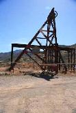
Fort Huachaca and Sierra Vista - Fort Huachuca is a United States Army installation located in Cochise County, in southeast Arizona, about 15 miles north of the border with Mexico. Sierra Vista, which annexed the fort in 1971, is located south and east of the post. Its major tenants are the Army Network Enterprise Technology Command, HQ for the Army Military Affiliate Radio System and the United States Army Intelligence Center. Libby Army Airfield is located on post and is on the list of alternate landing locations for the space shuttle. The fort is also home to a radar-equipped aerostat, one of a series maintained for the Drug Enforcement Administration and, when extended, supports the DEA drug interdiction mission by detecting low-flying aircraft attempting to penetrate the United States.
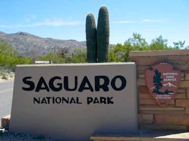
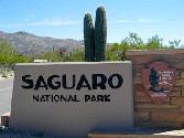
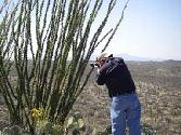
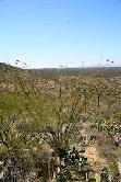
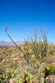
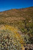
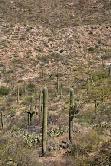
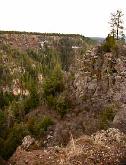
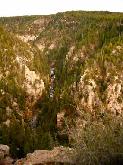
Sunday, March 15 – We had an easy day, with a trip back into Tucson, specifically to visit the Saguaro National Park.
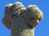
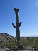
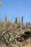
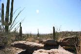
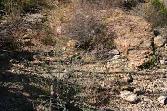
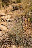
Saguaro National Park - Saguaro National Park is divided into two sections, lying approximately 20 miles east and 15 miles west of the center of the city of Tucson. Both sections conserve fine tracts of the Sonoran Desert, including ranges of significant hills, the Tucson Mountains in the west and the Rincon Mountains in the east. We visited the eastern section of the park, and saw many, many fine examples of the park’s namesake - the saguaro cactus, which is native to the region. Many other kinds of cactus, including barrel cactus, cholla cactus, and prickly pear, are also abundant in the park. What is somewhat unique about the eastern park is that it starts off in the Sonoran Desert and gradually gives way to a coniferous forest of the Rincon Mountains. It was truly beautiful!
|
In-N-Out Burger – We were so excited to find an In-N-Out Burger joint on Broadway in Tucson. We found In-N-Out on our trip to San Diego in June 2006, and have sought them out on our trips out west. What makes In-N-Out Burgers so great? Well, it isn’t because of its limited menu consisting of only three different sandwiches: the hamburger, cheeseburger, and "Double-Double" (double meat/double cheese). It also has the requisite French fries and fountain drinks, as well as three flavors of milkshakes. For us, it is all about the hamburgers that come with incredibly fresh lettuce, tomato, with or without onions (the customer is asked upon ordering, and may have them fresh or grilled), and a sauce, which is called "spread." Little did we know that we went to the store in Tucson that broke company records for most burgers sold in one day along with the most sold in one week when it opened in 2005. We love the West!
|
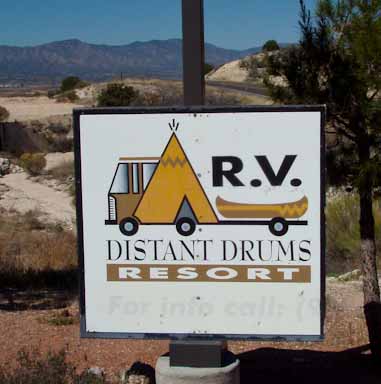
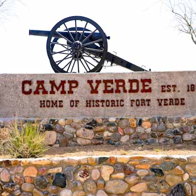
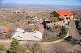
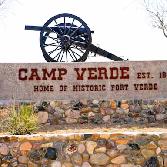
Monday, March 16 – (Happy Birthday to our nephew Quinn and Lota’s college roommate Kristi!) This is another travel day – this time from Benson through Tucson to Phoenix on I-10, merging on I-17 to go north toward Flagstaff. Our destination was Camp Verde, about 90 miles north of Phoenix, and in the heart of beautiful red rock country. Our “home” for the next several days is the Distant Drums RV Resort. This was an outstanding resort, and we will definitely return on our travels to Arizona. Here are some photos from Distant Drums.
|
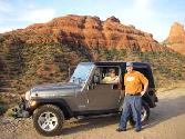
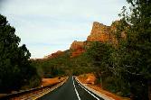
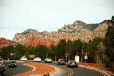
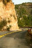
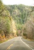
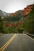
Tuesday, March 17 - Happy St. Patrick's Day! We (all four of us) spent this day driving around central Arizona -- from Camp Verde to Jerome to Sedona. We soaked in the scenery and took quite a number of photos. Here's some background info, along with the photographs!
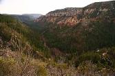
We drove from Camp Verde to Jerome through two lovely small towns -- Cottonwood and Clarkdale. One thing that we wanted to do, but couldn't because they were completely booked, was to take the Verde Canyon Railroad. Many locals highly recommended it, so its on our list for the next trip. The Verde Canyon Railroad is a heritage railroad near Clarkdale that opened in 1912 to support the copper mines at Jerome. The Santa Fe Railway operated and owned the 38-mile branchline from 1912-1989, providing coal to the Phoenix Cement Company, and shipping copper and cement outbound. Passenger service resumed in November 1990, with the current excursion being a 4-hour trip, 40-mile roundtrip from Clarkdale to the ghost ranch of Perkinsville and back. The route is nestled between two national forests and adjacent to a designated wilderness area, follows the Verde River the entire way. During the spring, bald eagles who make Verde Canyon their home are quite the photographer's feast.
|
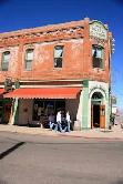
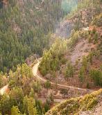
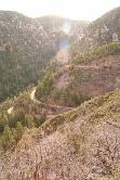
Jerome - A mining camp named Jerome was established on the side of Cleopatra Hill in 1883. It was named for Eugene Murray Jerome, a New York investor who owned the mineral rights and financed mining there. Jerome was incorporated as a town on March 8, 1889. The town housed the workers in the nearby United Verde Mine, which was to produce over $1 billion in copper, gold and silver over the next 70 years. Jerome became a notorious "wild west" town, a hotbed of prostitution, gambling and vice. On February 5, 1903, the New York Sun proclaimed Jerome to be "the wickedest town in the West." In 1915 the population of Jerome was estimated at 2,500.
By 1932, the price of copper had sunk to 5 cents per pound, and the United Verde closed until 1935, when Phelps Dodge bought the mine for $21 million. The United Verde and Jerome prospered in the war years, but the end was now in sight. Phelps Dodge closed its nearby smelter in 1950. In 1953, the last of Jerome's mines closed, and much of the population left town. Jerome's population reached a low point of about 50 people in the late 1950s, and was known as a ghost town. In 1967, Jerome was designated a Historic District, and a National Historic Landmark in 1976.
Today, Jerome is a tourist destination, with many abandoned and refurbished buildings from its boom town days. Jerome has a large mining museum, presenting the town history, labor-management disputes, geological structure models, mineral samples, and equipment used in both underground and open-pit mining. The National Historic Landmark designation has assured architectural preservation in this town, a mile high on the side of Mingus Mountain.
|
![]()
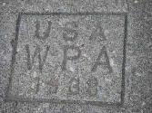
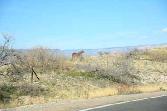
Scenery from the road to Cottonwood Sedona's red rocks in the distance Jerome State Park headquarters perched on the side of Mingus Mountain Old building in Jerome that is now a private residence The mining town of Jerome Preservation of this town has been an "uphill" battle A number of projects in Jerome with the WPA stamp Grand Hotel with new restaurant, the Asylum Another view of the Hotel Connor Beautifully restored home Surgeon's House, now a bed and breakfast Another view of the Sedona red rocks in the distance One of the new establishments in the tourist destination of Jerome Lots of artistic whimsy in Jerome Another ghost town just outside of Jerome Beautiful horse posing for a photo!
|
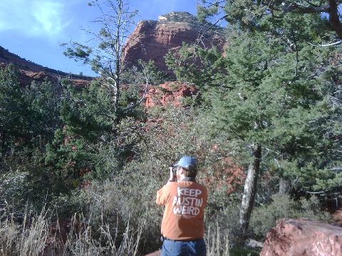
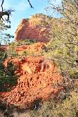
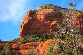
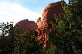
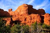
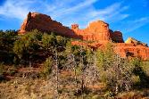
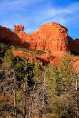
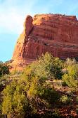
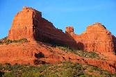
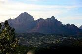
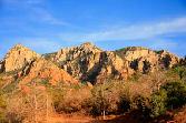
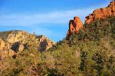
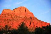
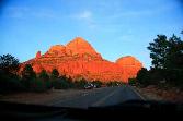
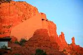
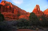
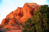
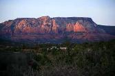
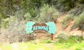
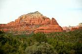
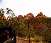
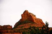
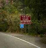
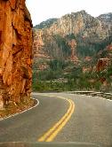
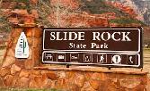
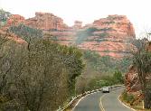
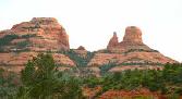
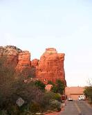
Sedona - Sedona is a community of almost 12,000 people in the northern Verde Valley. Sedona's main attraction is its stunning array of red sandstone formations, the Red Rocks of Sedona. The formations appear to glow in brilliant orange and red when illuminated by the rising or setting sun. The Red Rocks form a breathtaking backdrop for everything from spiritual pursuits to the hundreds of hiking and mountain biking trails. Sedona is named after Sedona Miller Schnebly (1877–1950), the wife of the city's first postmaster, who was celebrated for her hospitality and industriousness.
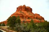
The famous red rocks of Sedona are formed by a layer of rock known as the Schnebly Hill Formation. The Schnebly Hill Formation is a thick layer of red to orange-colored sandstone found only in the Sedona vicinity. Among the rock formations is one that closely resembles the character Snoopy lying on top of his doghouse. Another nearby rock is said to resemble Lucy, also from Peanuts. Other landmark rock formations include Coffeepot Rock, Bell Rock, Cathedral Rock, Chimney Rock, Courthouse Butte, the Mittens, the Cow Pies, and the Rabbit Ears.
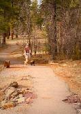
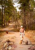
We took the Jeep on a couple of "primitive" road tracks, and the doggies spent most of their time in our laps. They didn't particularly like the bumpiness, but the photos we captured were terrific! Here they are:
|
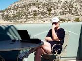
Wednesday, March 18 - This was a day of "hanging out!" Lota had a board call that lasted about four hours, and we then did household chores -- including laundry and website updating! These days are fun because we can do these things at our own pace.
|
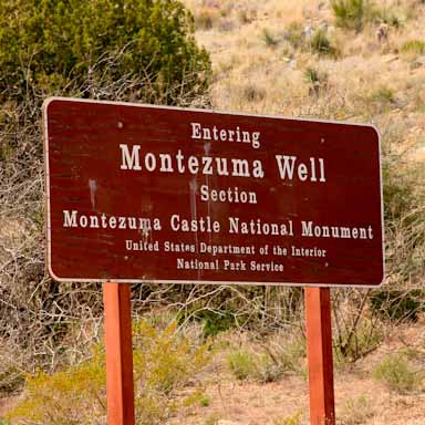
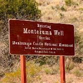
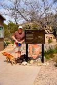
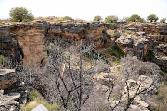
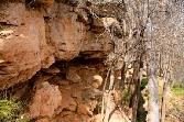
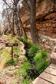
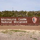
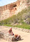
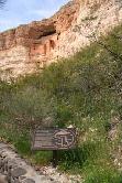
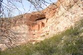
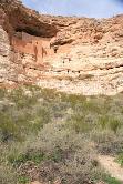
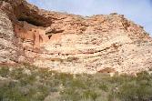
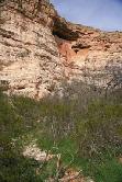
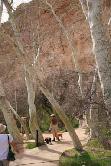
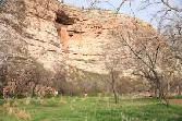
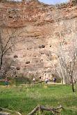
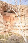
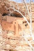
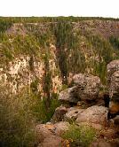
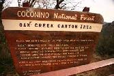
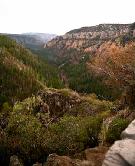
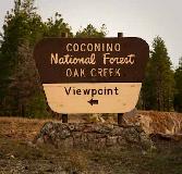
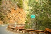
Thursday, March 19 - Back into the Jeep for a day of exploration! We took a circuitous route, starting in Camp Verde and going over a primitive road to Montezuma Well and Montezuma Castle and then up Oak Creek Canyon for a spectacular drive up 2,500 feet in elevation. Here are a few facts about these sites.
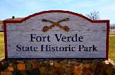
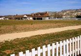
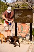
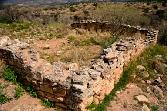
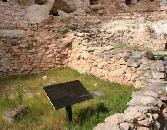
Camp Verde and Ft. Verde State Historical Park - Fort Verde State Historic Park, in the town of Camp Verde, is a small park that attempts to preserve parts of the Indian Wars-era fort as it appeared in the 1880s. Settlers in the mid-1800s near the Verde River grew corn and other crops with the prospect of getting good prices from nearby Prescott, which was the territorial capital, and from nearby miners. The rapid increase in population for the mining economy disrupted the hunting and gathering environments of the local Indian tribes, the Dilzhe'e Apache and Yavapai. In turn, they raided the farmers' crops for food. The farmers requested military protection from the U.S. Army and, in 1865, although Arizona was still only a territory, the infantry arrived. After approximately 1500 local Indians were placed on a reservation by 1872, the army's role changed from protecting the settlers to ensuring that the Indians stayed on the reservation. The last major battle with uprising Indians took place in 1882 at the Battle of Big Dry Wash. The fort was never enclosed by walls or stockades and never saw fighting on site.
|
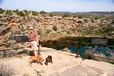
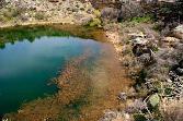
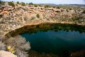
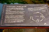
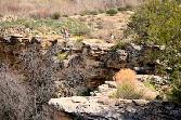
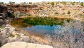
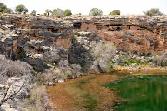
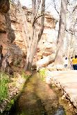
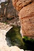
Montezuma Well - This national historical site is a natural limestone artesian well through which some 1,400,000 gallons of water flow each day. It is located 11 miles northeast of Montezuma Castle (coming up next). The water is highly carbonated and contains high levels of arsenic. Montezuma Well's outflow has been used for irrigation since the 8th century. Part of a prehistoric canal is preserved at the picnic ground, and portions of the original Hohokam canal are still in use today. The Yavapai Indians believe they emerged into this world through the well, and as such, it is a very sacred place to them.
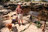
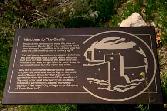
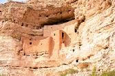
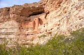
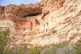
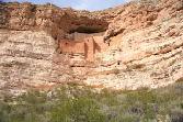
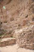
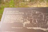
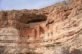
Montezuma Castle - This national monument features well-preserved cliff dwellings. They were built and used by the pre-Columbian Sinagua people around 1400 AD. Several Hope clans trace their roots to immigrants from the Montezuma Castle area. When European Americans discovered the dwellings in the 1860s, they named them for theAztec emperor of Mexico, Montezuma, due to mistaken beliefs that the emperor had been connected to their construction. These cliff dwellings appear to have been abandoned by the Sinagua people in 1425 AD, probably due to warfare, drought, and clashes with the newly-arrived Yavapai people. The five-story stone and mortar dwellings contain 20 rooms and once housed about 50 people. A natural overhang shades the rooms and shelters them from rain. Another part of the cliff wall bears the marks of an even larger dwelling, which has not survived. The dwellings and the surrounding area were declared a U.S. National Monument in 1906.
|
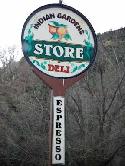
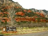
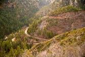
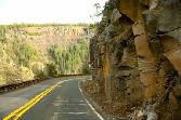
Oak Creek Canyon - This canyon is a 12-mile-long river gorge located along the Mogollon RIm and located between the cities of Sedona and Flagstaff. The canyon is often described as a smaller cousin of the Grand Canyon because of its scenic beauty. State Route 89A enters the canyon from the south just outside the downtown Sedona area and continues a steady climb through the gorge along the river until the northern end, where a series of hairpin turns called the "Oak Creek Switchbacks" take you all the way up to the rim at 6,500 feet above sea level. The Oak Creek Canyon-Sedona area is the second most popular tourist destination in Arizona, second only to the Grand Canyon. We had a marvelous trip, and enjoyed lunch mid-way at the Garland's Indian Gardens. Garland's is Sedona's oldest country store and is in a building that was originally the Thompson homestead, established in 1876.
|
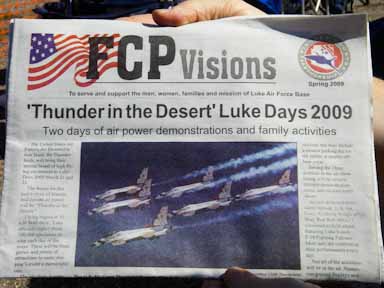
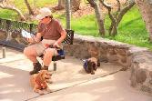
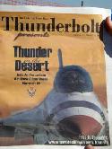
Friday, March 20 - Lota had an early morning board call (6:30a, local time) that lasted an hour. After morning coffee, we cleaned up the Wagon and prepared for departure to the Phoenix area. We left at about 11:00a, and arrived at our destination, the Leaf Verde RV Resort in Buckeye, a town about 30 miles west of Phoenix. Our purpose for being on the west side of Phoenix was to be close to Luke Air Force Base, which held an air show on Saturday and Sunday, March 21 and 22 called "Thunder in the Desert." Lota's college roommate, Kristi, and husband Jerry, had flown in from Lubbock, Texas to see their son, Brett (a junior at the Air Force Academy), perform at the air show. Brett is a member of the Wings of Blue parachute jumping team, and has made 266 (to date) jumps. After setting up camp, the five of us (Cary, Lota, Kristi, Jerry and Brett) all went to dinner at Macayo's, a terrific Mexican food restaurant.
|
![]()
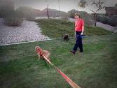
Jerry, Brett, Lota & Kristi at Macayo's Lota & Jordan in Kristi & Jerry's "rental car" Molly & Jordan finally find some grass in the desert!
|
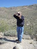
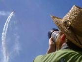
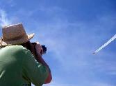
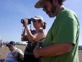
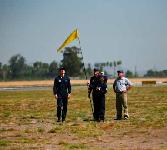
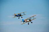
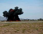
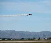
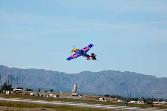
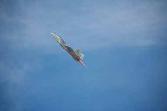
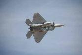
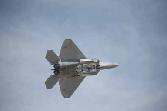
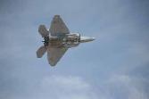
Saturday, March 21 - We met Kristi and Jerry at Luke Air Force Base to go into the air show. We were novices at this, so we were happy to have "experts." Sadly, a stabilizer malfunctioned on the C-17 due to take the Wings of Blue up to jump, so the jumps were cancelled. We watched most of the air show, and Cary took some fabulous photos -- see below.
|
![]()
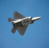
Luke AFB "Thunder in the Desert" The US Air Force Academy's junior & senior parachuting team is called the "Wings of Blue" Brett, a little disappointed about the cancellation of the jumps Cary is ready to photograph! Look at that beautiful sky! Jerry, Kristi & Cary prepare for the show Jerry, Kristi & Lota waiting for the show to begin! This is the spot that the Wings of Blue would have landed! The Air Force Reserve Biplane Air Force A-10, nicknamed the Warthog The Red Bull MiG - beautifully restored plane Simulated bombing by the MiG The Red Bull acrobatic plane The most amazing demonstration - the Air Force F-22 stealth fighter plane
|
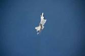
Sunday, March 22 - After enjoying a wonderful dinner with Kristi, Jerry & Brett last night at P.F. Chang's, Brett was pretty certain that the jumps would be canceled again on Sunday due to high winds. However, the winds were relatively calm at 10:00, so the Wings of Blue loaded up in the C-17 and took off. We were a little late in getting up this morning, so we went to the west side of the airfield to photograph the jumps. Unfortunately, the winds turned gusty just prior to the jumps, and they were canceled. Here are some C-17 photos -- what a huge plane.
|
What's next?
The next update will start with Monday, March 23, and feature a whole day of watching Brett and the Wings of Blue practicing their jumps at Buckeye. Kristi, Jerry, Cary and Lota (along with Molly & Jordan) parked our chairs within 20 yards of their landing site. At first, it was nerve wracking to watch Brett jump, but we soon were just simply enjoying their beautiful glides and soft landings. On Tuesday, March 24, Kristi and Jerry flew back to Lubbock, and we moved the Waggin' Wagon across to the eastern valley and parked at Eagle View RV Resort on the Fort McDowell Indian Reservation. We took a beautiful drive through the Superstitions and enjoyed a picture perfect sunset. On Wednesday, March 25, we are planning to play golf about 15 minutes away at Sun Ridge Canyon. Stay tuned for the next update!
|
|